Most Dangerous Roads in the World Where Driving Is Risky

Explore the most dangerous roads in the world, where extreme terrain, weather, and isolation turn everyday driving into a serious risk. Learn what makes them so hazardous.
The most dangerous roads in the world rarely look like scenes from disaster movies. More often, they are ordinary routes — used for work, tourism, or logistics — where people drive every day. But behind this apparent normality lies a different reality: a combination of climate, terrain, and infrastructure that turns every trip into a test of endurance and judgment.
The global context is already alarming. Road accidents claim around 1.19 million lives each year, with tens of millions more people injured. Against this backdrop, certain roads stand out — not as isolated hazards, but as places where risk is built into the system itself.
One of the clearest examples is the Dalton Highway in Alaska. This is not just a remote route; it is a road where the surface itself becomes a challenge. Much of it consists of gravel and dirt, remaining rough in both summer and winter. Conditions can change in real time, with official status shifting from “difficult” to “hazardous” or even complete closure. In 2025, severe flooding damaged large sections of the highway, underscoring a key point: even when open, stability is never guaranteed.
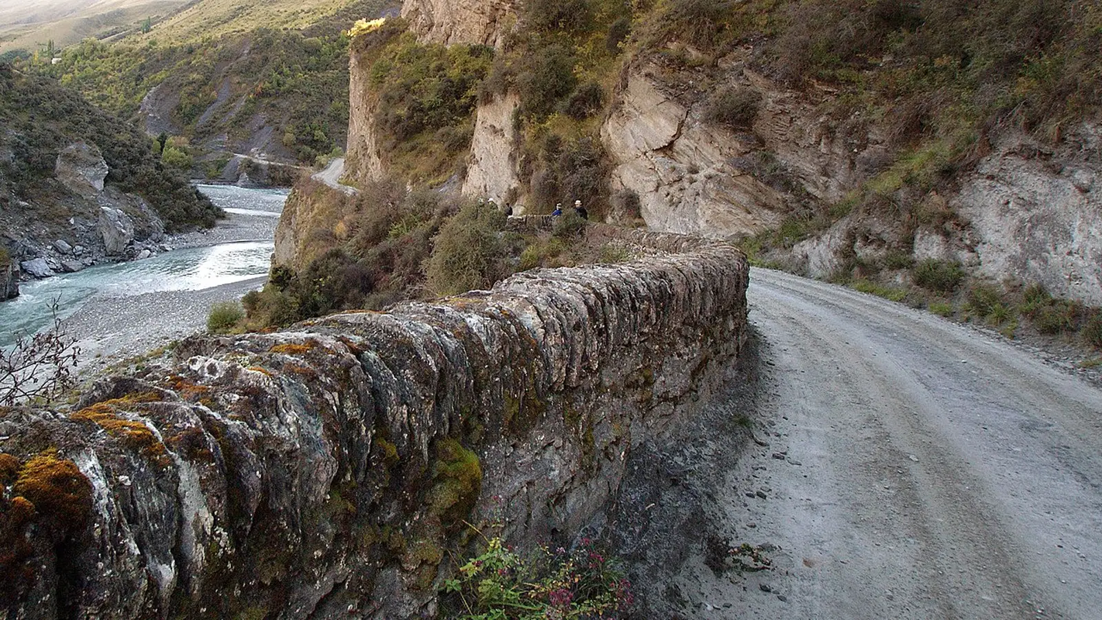
_(8115471356).jpg)
A very different but equally telling case is Skippers Canyon Road in New Zealand. Narrow and unsealed, it is carved directly into the canyon walls. The risk level is such that many rental companies prohibit vehicles from being driven there. Even the infrastructure requires constant attention, with sections periodically closed for maintenance. It is a rare example where popularity as a tourist attraction does not reduce risk — it highlights it.
In Norway, Trollstigen has long been known as one of Europe’s most scenic roads. But recent developments reveal another side. Due to rockfall risks, the route can be fully closed for extended periods. This is not precautionary — it is a response to real, ongoing danger. Heavy rain and unstable slopes turn even a perfectly engineered mountain road into a dynamic hazard zone.
Moving to Asia, the conditions become even more extreme. Zoji La in India is a high-altitude pass whose very existence depends on a narrow seasonal window. Sub-zero temperatures, strong winds, and avalanche-prone terrain define the environment. When the road reopens after winter, it does not become safe — only passable.
The same pattern applies to the Karakoram Highway in Pakistan. In recent years, the route has been repeatedly affected by landslides triggered by monsoon rains. These are not isolated incidents: closures often occur at multiple points simultaneously, and travelers are officially advised to postpone journeys. Risk here is not occasional — it is recurring.
Some routes are shorter but no less dangerous. The access road to Fairy Meadows is one such example. It is open only to local operators, which already signals its difficulty. Narrow, gravel-based, and with minimal room for maneuver, the risk is managed not through infrastructure, but through restricted access.
Interestingly, some roads remain iconic symbols of danger, yet current data about them is difficult to verify. North Yungas Road in Bolivia is one of these cases. Known widely as the “Death Road,” it retains its reputation, but reliable recent statistics on accident rates are not readily available. Here, perception has outpaced confirmed data.
Looking across these examples, a pattern emerges. Danger is rarely caused by a single factor. Instead, it is the result of a combination: poor surfaces, narrow lanes, steep drops, unstable weather, remoteness, and limited emergency support. Most importantly, these factors are constantly changing.
In recent years, climate has become an increasingly decisive element. Floods, heavy rains, landslides, and rockfalls are no longer rare events — they are recurring threats. This is evident on the Dalton Highway, the Karakoram Highway, and Trollstigen alike. A road can be open in the morning and closed by evening.
In response, approaches to risk management are evolving. Real-time monitoring systems are used in places like Alaska. Rental restrictions are enforced on routes such as Skippers Canyon. Entire roads may be closed at the first sign of danger, while others are accessible only through local operators.
Ultimately, the most dangerous roads in the world are not just about extreme geography. They are about adaptation. Driving here is not just a skill — it is a continuous process of decision-making. And current patterns suggest that this challenge is only becoming more relevant.
Allen Garwin
2026, Apr 16 21:34